|
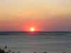
Mozambique covers an area of 800 thousand sq km with more than 2500km of coastline. Extensive coral reefs fringe moast of the coastline, particularly in the north and the rich marine life coupled with the white sandy beaches make the coastline of Mozambique a highlight on any holiday to Mozambique.
Northern Mozambique
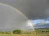
In northern Mozambique the land rises much sooner from the coast forming mountains and plateaus bordering with Malawi, Zimbabwe and Zambia. The Chimanimani mountains are home to Mozambique's highest peak, Mt Binga (2436m), and on the borders of the Gorongoza National Park the Gorongosa Massif is known for its rich and varied flora, fauna and birdlife.
The remote Niassa Conservency in the far north is rugged territory, west of here the privately run Manda Wilderness conservation area borders on Lake Niassa (Lake Malawi). The river Rovuma forms the border with Tanzania in the north.
Central & Southern Mozambique
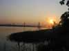
The Zambezi River dominates central Mozambique with its mighty valley and delta plains, and another of Southern Africa's largest rivers, the Limpopo, flows through the south of Mozambique. The area south the Limpopo River forms part of the Great Limpopo Transfrontier Park along with Kruger National Park in South Africa.
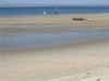
The lowland plains lead out onto long sandy beaches often with inland lagoons forming barrier lakes. These lagoons can be salt or fresh water and attract a wide variety of birds.
For more information click on the area of the map you are interested
in.
|